YOU NEED A BETTER VIEW OF YOUR PROPERTY: WHAT AERIAL IMAGERY CAN REVEAL
Owning or managing a property means understanding the entire site—not just what can be seen from the ground.
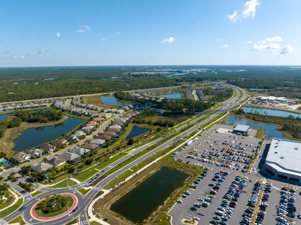
Aerial imagery provides a clear view of building layouts, parking areas, access roads, drainage features, and surrounding conditions that are difficult to visualize from street level.
Whether you own or manage a commercial property, community, development project, or large parcel of land, aerial photography can provide valuable insight and documentation.
WHAT AERIAL IMAGERY CAN HELP YOU SEE
From above, property owners and managers can quickly identify features and conditions that are difficult to evaluate from ground level.
Aerial imagery can help reveal:
• Building layouts and roof conditions
• Parking areas and traffic flow
• Drainage patterns and retention ponds
• Access roads and site entrances
• Property boundaries and adjacent land uses
• Construction progress and site development
Having a current aerial view can help support planning, maintenance, inspections, documentation, and communication with stakeholders.
WHY AN OVERHEAD PERSPECTIVE MATTERS
Ground-level inspections provide important information, but they don’t always tell the complete story.
An aerial perspective allows property owners, managers, engineers, contractors, and developers to see the entire site in a single view.
This broader perspective can help identify:
• Areas requiring maintenance
• Stormwater and drainage concerns
• Access and circulation issues
• Site improvements and changes over time
• Opportunities for future development
Having accurate aerial imagery can improve decision-making and provide a valuable visual record of current site conditions.
HOW AERIAL IMAGERY SUPPORTS BETTER DECISIONS
Aerial imagery is more than just a photograph from above. It provides a visual tool that can support planning, inspections, maintenance, documentation, and project communication.
Property owners, managers, developers, contractors, engineers, and community associations can all benefit from having current aerial imagery available when evaluating a site.
A current aerial image can provide context that is difficult to capture from the ground and can help stakeholders quickly understand the overall layout and condition of a property.
SEE YOUR PROPERTY FROM A NEW PERSPECTIVE
Whether you’re managing a commercial property, overseeing a development project, maintaining a community, or simply need updated aerial documentation, professional aerial imagery can provide valuable insight.
Sky Scout Drones provides aerial photography services throughout Southwest Florida.
Contact us today to learn how aerial imagery can help you better understand and document your property.