WHAT IS AN ORTHOMOSAIC MAP? A GUIDE TO DRONE MAPPING
When most people think of drone imagery, they picture beautiful aerial photographs. While those images are excellent for marketing and visual documentation, many commercial, agricultural, engineering, and construction projects require something far more precise. That’s where an orthomosaic map comes in.
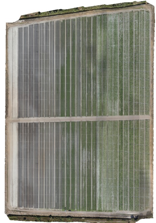
An orthomosaic is a high-resolution aerial image created by combining hundreds or even thousands of overlapping drone photographs into a single, seamless, georeferenced map. The result is an extremely accurate image that allows users to measure distances, document conditions, monitor changes over time, and make informed decisions with confidence.
WHY BUSINESSES USE ORTHOMOSAIC MAPS
Orthomosaic maps provide far more than an attractive aerial image. Because they are accurately stitched together and georeferenced, they become a valuable planning and documentation tool for a wide range of industries.
Organizations use orthomosaic mapping to:
• Document existing site conditions before work begins.
• Monitor construction progress throughout a project.
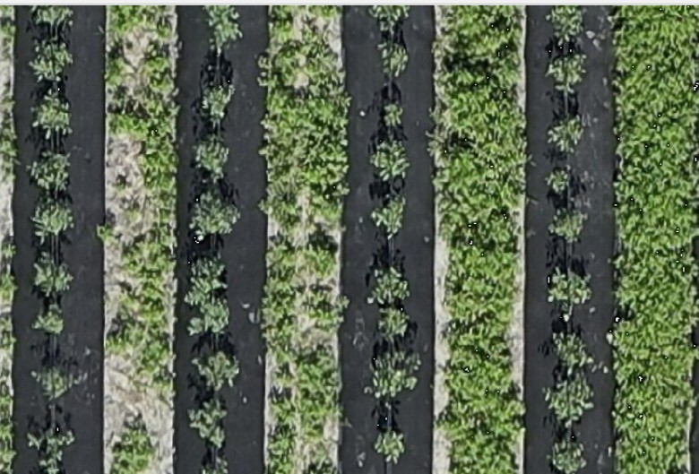
• Evaluate agricultural fields and crop conditions.
• Assist with engineering, planning, and site management.
• Create accurate visual records for inspections and reporting.
Unlike a standard aerial photograph, an orthomosaic allows users to reference consistent measurements and compare changes over time, making it an important asset for commercial projects.
INDUSTRIES THAT BENEFIT FROM ORTHOMOSAIC MAPPING
Orthomosaic mapping provides valuable information across many industries by delivering accurate, high-resolution aerial imagery that supports planning, documentation, and long-term project management.
Industries that commonly benefit include:
• Agriculture and precision farming
• Construction and site development
• Engineering and consulting firms
• Commercial property management
• Municipal and public works projects
• Environmental monitoring
• Land development and planning
Because every pixel in an orthomosaic is geographically referenced, users can confidently review existing conditions, monitor progress, and communicate project information with clients, contractors, and stakeholders.
HOW ORTHOMOSAIC MAPS SUPPORT BETTER DECISIONS
Orthomosaic maps provide more than a visual overview—they deliver reliable information that helps organizations make informed decisions throughout the life of a project.
Whether documenting existing site conditions, monitoring construction progress, evaluating agricultural operations, or supporting engineering and planning efforts, high-resolution orthomosaic imagery provides a consistent and accurate view of the entire project area.
Because every image is georeferenced, teams can compare changes over time, improve communication among stakeholders, and maintain a permanent visual record that supports reporting and project management.
READY TO DISCUSS YOUR NEXT MAPPING PROJECT?
Whether you’re managing an agricultural operation, overseeing a construction project, planning a commercial development, or documenting existing site conditions, Sky Scout Drones can deliver high-resolution orthomosaic mapping solutions tailored to your needs.
Using professional-grade drone technology and advanced photogrammetry processing, we provide accurate, detailed imagery that helps clients visualize projects, improve planning, and make confident decisions.
Ready to see your project from a new perspective? Contact Sky Scout Drones today to learn how professional orthomosaic mapping can provide the accurate, georeferenced aerial data you need to plan, monitor, and document your next project with confidence.