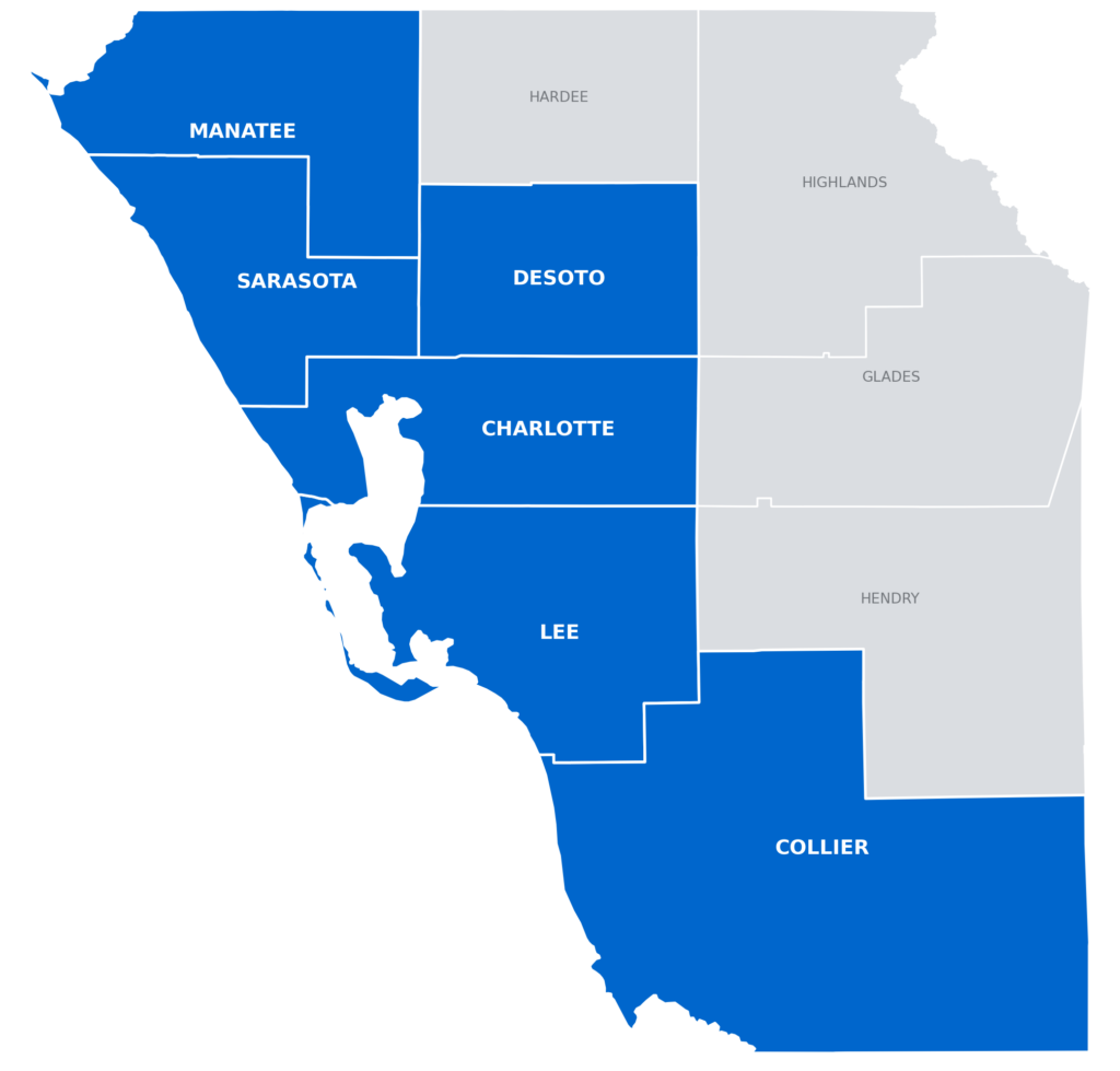
Sky Scout Drones provides professional imaging, inspection, mapping, and data services throughout Southwest Florida. From real estate and commercial properties to construction, infrastructure, and land projects, our full range of services is available across our coverage area.
Manatee County Bradenton • Palmetto • Anna Maria • Holmes Beach • Bradenton Beach • Longboat Key • Lakewood Ranch • Ellenton • Parrish • Bayshore Gardens
Sarasota County Sarasota • Venice • North Port • Longboat Key • Siesta Key • Nokomis • Osprey • Englewood • Laurel • South Venice • Bee Ridge • Fruitville
DeSoto County Arcadia • Nocatee • Southeast Arcadia
Charlotte County Punta Gorda • Port Charlotte • Englewood • Rotonda West • Manasota Key • Charlotte Harbor • Harbour Heights • Grove City
Lee County Fort Myers • Cape Coral • Bonita Springs • Estero • Sanibel • Fort Myers Beach • North Fort Myers • Lehigh Acres • Alva • Pine Island • Saint James City • San Carlos Park
Collier County Naples • Marco Island • Everglades City • Immokalee • Golden Gate • Naples Park • Pelican Bay • Lely Resort • Vineyards • Orangetree
OUTSIDE OUR PRIMARY SERVICE AREA
Sky Scout Drones also considers projects outside our primary Southwest Florida service area based on project scope, location, travel requirements, scheduling, and overall project economics.
If your project is outside the counties listed above, contact us with the details and we’ll let you know whether we can support the assignment and what travel or project-specific costs may apply.