What Ground-Level Photos Can’t Show: Seeing the Complete Picture From Above
The camera isn’t lying. It may just be standing in the wrong place.
You can photograph every wall, doorway, and corner of a property and still leave someone wondering how everything fits together. Put the camera in the air and suddenly the building, surrounding land, access, and neighboring features become one understandable scene.
Watch what happens in the next 29 seconds. Nothing on the ground changes. Only the viewpoint changes—and that changes the entire story.
See What Changes From Above — In Just 29 Seconds!
Same Property. Completely Different Story.
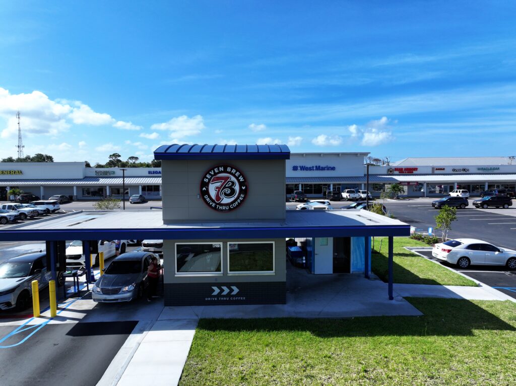
Look at the commercial building that opens the video. From the ground, you see a building. From above, you see a property.
The building is still important, but now it has a setting. You can see how it occupies the site, what surrounds it, and how the visible pieces connect. Information that was hiding just outside the ground-level frame is suddenly right in front of you.
That is why a strong aerial image does more than look dramatic. It reveals the part of the story that the ground simply cannot show.
The “Now I Get It” View
Have you ever looked at a group of close photographs and tried to assemble them in your head? Where is this feature compared with that one? What is outside the frame? Are these photographs even facing the same direction?
Then one wider view appears and everything clicks: “Now I get it.”
That reaction is useful. A buyer understands a property’s setting. A contractor sees an active site as a whole. A property owner can point to a condition that was difficult to describe. A commercial or government team can discuss the same location without everyone imagining something different.
One image has replaced the guessing.
Stop Explaining. Start Showing.
Sometimes it takes several ground photographs, a marked-up map, and a long explanation to communicate what one carefully chosen aerial image can show almost instantly.
That matters when the person viewing the imagery was not standing beside the photographer. The image must speak for itself. It should show what is there, how the important pieces fit together, and why the scene matters without requiring someone to explain every photograph.
Yes, the view from above can deliver a gee-whiz moment. But the real payoff comes immediately afterward: the viewer understands something that was unclear before.
Higher Isn’t Better. Smarter Is.
Getting the drone into the air is the easy part. Choosing the view that tells the story is where judgment matters.
Fly too high and the subject can shrink into the scenery. Stay too close and the image may miss the connections the client needs to show. The right answer may be a lower angled view that keeps a building prominent, a straight-down photograph that clarifies how a parcel is arranged, or a combination of ground and aerial images that covers both detail and context.
The drone is the tool. The perspective is the decision. The goal is not to fly as high as possible – it is to show exactly what the client needs others to understand.
What Are You Missing From the Ground?
Ground-level photography is excellent at showing individual details. But when those details leave people asking, “Where is that?” or “How does this fit together?” taking more photographs from the same viewpoint may not solve the problem.
You may not need more ground-level photos. You may need the right aerial view.
Let Sky Scout Drones show you what the ground can’t – with imagery designed to make the complete scene easier to see, understand, and share.
Explore our latest videos on YouTube, browse our online portfolio, or contact Sky Scout Drones to discuss your next project. We’d love to help you tell your story from above.